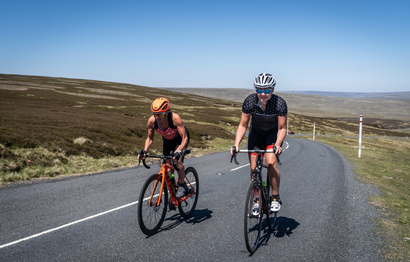
Often overlooked as people head up the M6 to the Lake District, or up the M1 to Yorkshire, sits the Forest of Bowland Area of Outstanding Natural Beauty (AONB). Filled with quiet winding lanes, this is a cyclist’s heaven offering everything you could want in a day’s ride.
This challenging route is 92km (approx 57miles) but packs in over 1500m (almost 5,000ft) of climbing. The road surface is generally very good, but be sure to bring your spares as there are stretches without phone signal if you were hoping the team car would save you!
Cycling Trough of Bowland & Lancashire Lanes
Starting in the Historic market town of Garstang, there are plenty of parking options with both street parking and pay & display car-parks. The description follows a clockwise loop but the route can be done either clockwise or anti clockwise, with both directions offering a mix of steep and steady climbs.
This is a fantastic ride route from Garstang but other possible start locations could be Chipping, Dunsop Bridge or Abbeystead depending where you’re based or are travelling into the area from - cycling must be amongst the best reasons to visit the Forest of Bowland and Ribble Valley areas!

Highlights include Trough road, cycling Easington fell and Beacon Fell & views of Morecambe bay from the top of Dolphinholme. There are plenty of cafes on route, with personal favourites including – The Cobbled Corner (Chipping) & Puddleducks (Dunsop Bridge) both suitably placed to reward after some hard climbing.
To make this an easy to follow cycling route we’ve provided downloadable GPX as well as some route instructions. The GPX download at the bottom of the page is the easiest option but for more details read the step by step route guide.
Cycle Route Guide - Forest of Bowland AONB
1) Ride North out of Garstang Town Centre on Lancaster Lane and before reaching the main A6 take a right onto Green Lane, quickly leaving the town and heading into green landscapes.
2) Take right turns at two consecutive T-Junctions onto Gubberford Lane and then Hazlehead Lane to loop vaguely East and then South towards Barnacre. After travelling south parallel to the M6 and West Coast Mainline you cross both heading East to reach a sweeping right hand corner.
3) Continue on the road heading south, passing several smaller lanes off to either side. Turn left up Butt Hill Lane (signed Bleasdale & Chipping) immediately after a stone bridge over the River Calder.
4) Butt Hill Lane offers the first climb to test the legs before easing and arcing right taking you down Hobbs Lane. Left at the T-Junction onto Bleasdale Lane, again signposted Bleasdale and Chipping and the road begins to drag again. You’re now in the Forest of Bowland AONB and you’ll soon see how it achieves this status.
5) Take a left and continue to climb up Delph Lane, the tough finishing climb of the regionally famous Oakenclough Road Race circuit. It’s one of those climbs that gets steeper as you go and squeezes you until easing just before the very top. Start to descend and enjoy the reward as you slingshot down and then up Harris End, opening fantastic views of Morecambe Bay and towards the Lake District fells.

6) Take a right turn at crossroads and head to the peaceful village of Dolphinholme, keeping left in the village and following quiet lanes before a sharp right turn back on yourself onto Bay Horse Road at the five way junction.
7) Enjoy the rolling Bay Horse Road before turning right and uphill at crossroads onto the twisty Proctor-Moss Road. Reaching the end of the road a left turn at the T-Junction takes you to Abbeystead with steep roads to roll down and then punch up.
8) Again turn right at the T-junction and join the Trough road - perhaps one of the best cycling roads in North Lancashire. A few minutes of slight downhill to Marshaw prepares you for the main Trough of Bowland climb. This is the easier side of this one so enjoy the steady climb beside the stream soon emerging from the shelter of trees onto the moorland, eventually flattening off before the cattle grid.

9) The flat doesn’t last long before dropping into the steep-sided valley known as the Trough of Bowland - you’ll continue with speed to reach a left turn at Dunsop Bridge and the possibility of a cafe stop at Puddleducks!
10) After another rolling section towards Newton take a right dropping down to cross a bridge before starting to climb sharply up Hallgate Hill. Take another right after passing the farm and head up Easington Fell. It’s a challenging pull to test the climbing legs - the trade off for the aforementioned easier side of Trough Road!
11) Navigation-wise you’re on a straight forward section of almost 8km without junctions, not deviating much from the SSW heading. After the hard climb enjoy a fast descent on the quiet lane before going left then right at two T-junctions at Cow Ark.

12) Follow a steady descent, again taking in part of a local road race loop, this time Bashall Eaves circuit. After a sweeping right hand corner go left at the T-junction for some flat open road and then more steady descending.
13) You drop down over a nice stone bridge and a couple of hundred metres after crossing the River Hodder turn right signposted Little Bowland. This quiet section of the loop is undulating and offers views over Longridge Fell to one side and Parlick and the Bowland Fells to the other.
14) Turn right at the T-junction upon arriving in the historic village of Chipping, just on the southern edge of the Forest of Bowland AONB. There’s the option of another cyclist friendly cafe available at the ‘Cobbled Corner’ - you can’t miss it!

15) Leave the village heading West and as the road starts to rise take a left turn down Parsonage Lane, eventually taking three right turns in a row onto Height Lane, Loud Bridge Lane and then after a narrow bridge over the stream onto Loud Bridge Back Lane.
16) Follow the lane as you climb yet again towards the prominent Beacon Fell, a popular spot for walkers with the country park and visitor centre. You’ll find woodland to your right and to the left you get commanding views over the Fylde Coast and towards Blackpool - try and spot the tower!
17) Beacon Fell Road traverses round the hillside before dropping sharply where we take a left turn. Two more lefts bring you to Bleasdale Road. The link to GPX file at the bottom of the page is helpful through this series of small lanes. You continue forward as Bleasdale Road becomes Stanalee Lane, signed towards Claughton.
![]()
18) Follow the main path of the lane without turning off and you’ll arrive at a T-junction where a right will take you on Billsborough Lane for a brief period before another right takes you onto Lydiate Lane.
19) Enjoy flatter roads as Lydiate Lane becomes Ducketts Lane then Lodge Lane and finally Stubbins Lane as you arrive back in Garstang to finish.
Download a GPX of the 'Forest of Bowland & Lancashire Lanes' route here.

